
Why Is Nepal So Vulnerable to Floods? Understanding the Geography Behind the Disaster
Nepal’s flood risk is not caused by rain alone. Heavy monsoon rainfall, steep mountains, landslides, fast rivers and the flat Terai all work together, allowing floods and debris to travel quickly downstream. Climate change is adding more pressure to an already vulnerable system.
· 12 min read
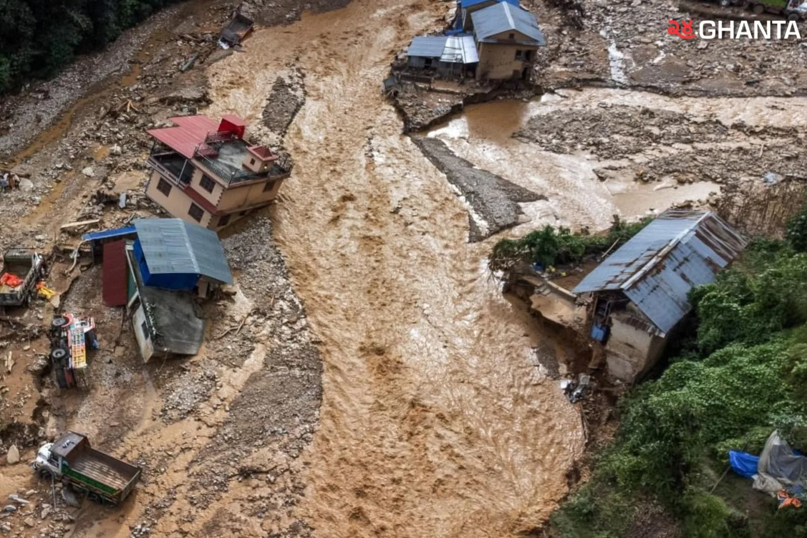
Every monsoon, people across Nepal watch rivers rise, roads disappear under water, hillsides collapse, and families rush to safer ground. It is easy to look at all of this and say, “Nepal floods because it rains a lot.”
But that is only part of the story.
Nepal is vulnerable to floods because many natural systems are connected at the same time. Heavy monsoon rain falls on very steep mountains. Water moves quickly into rivers. Landslides add mud, rocks, and debris. Those rivers then carry everything downstream toward the much flatter Terai, where water can spread across large areas.

In simple terms, Nepal’s geography makes it possible for water to move from high mountains to low plains very quickly, and that is why floods can become so destructive.
Nepal’s Shape Matters More Than Most People Realize
To understand the problem, imagine Nepal from north to south.
In the north are the Himalayas, including some of Earth's highest mountains. Below them are steep hills and deep valleys. Farther south are the Chure hills, and then the land opens into the much flatter Terai plains.
That means Nepal goes from extremely high mountains to low, flat land within a relatively short distance.
This matters because water always moves downhill.
When heavy rain falls on steep slopes, it can quickly run into small streams, then larger rivers. In flatter areas, water may spread more slowly. In mountain areas, it can gather speed and force as it moves downhill.
ICIMOD has repeatedly pointed out that Nepal’s steep terrain, fragile geology, monsoon climate, and active mountain environment make the country highly exposed to landslides, flash floods, debris flows, and other water-related hazards.
A simple way to picture Nepal is this:
The mountains act like a giant funnel, and the Terai acts like a flat tray below it.
Then Comes the Monsoon
Nepal does not receive rainfall evenly throughout the year.
A large share of the country’s annual rain falls during the summer monsoon, generally between June and September. ICIMOD notes that Nepal can receive around 80% of its annual rainfall during the monsoon season.
That means a huge amount of water can enter rivers within just a few months.
The mountains also influence how rain falls. Moist air is forced upward when it reaches high terrain. As the air rises and cools, the moisture can condense and fall as rain.
This is one reason rainfall can be very heavy in some parts of Nepal and much lower in others.
A powerful example came in late September 2024.
Nepal’s Department of Hydrology and Meteorology reported that 25 weather stations in 14 districts broke previous 24-hour rainfall records on September 28, 2024. Daman recorded 517 millimeters of rain over three days. The event caused major flooding in the Bagmati, Narayani, and Koshi river basins.
So the first part of Nepal’s flood problem is simple:
A lot of rain can fall in a short time over very steep land.
What Happens After the Rain Hits the Ground?
This is where Nepal’s terrain becomes especially important.
Some rain soaks into the soil. But if the rain is very heavy, or if the ground is already saturated, more water begins flowing over the land and into streams.
Small streams join bigger ones.
Those streams feed rivers.
In steep mountain areas, this process can happen quickly.
That is why rivers can rise very fast during intense rain, sometimes creating flash floods.
The World Bank has noted that Nepal’s mid-hill areas are especially prone to flash floods linked to high-intensity or prolonged rainfall, while the Terai is more prone to broad river flooding.
But in Nepal, floodwater often carries much more than just water.
Sometimes the River Carries Part of the Mountain
Nepal’s mountains are constantly being shaped by erosion, landslides, and river action.
Many slopes contain loose soil, broken rock, older landslide material, and sediment.
During heavy rain, slopes can become unstable.
When a landslide falls into a river, it can add mud, sand, gravel, boulders, trees, and soil.
That makes the flood much more destructive.
A river carrying only water is dangerous. A river carrying water, rocks, mud, and trees can behave more like a moving wall of debris.
The 2021 Melamchi disaster is a strong example.
ICIMOD found that the disaster was not caused by one simple factor. Rainfall, erosion, landslides, river blockage, and huge amounts of sediment all interacted. Researchers estimated that around 13 million cubic meters of sediment were deposited along the studied stretch of the river.
ICIMOD explained the scale by saying that this amount would be enough to cover the area of Kathmandu inside the Ring Road with roughly 30 centimeters of sediment.
That gives a much clearer picture of what mountain floods can carry.
A Landslide Can Even Block a River
One of the most dangerous situations happens when a landslide blocks a river completely.
Imagine a river flowing normally.
Then a hillside collapses and fills the river channel with rock and soil.
The water cannot continue flowing normally, so it starts collecting behind the blockage.
A temporary lake can form.
If that natural dam later breaks, a large amount of stored water can suddenly rush downstream.
This is called a landslide dam outburst flood.
ICIMOD found evidence of river blockage and later sudden release during the Melamchi disaster.
This is important because it shows that the place where people are flooded may not be the place where the problem began.
A landslide many kilometers upstream can create danger for communities far downstream.
Nepal’s Rivers Connect the Mountains to the Plains
Nepal’s major rivers do not stay in one region.
The Koshi flows through eastern Nepal. The Gandaki or Narayani system runs through central Nepal. The Karnali drains western Nepal.
There are also other important rivers, including the Mahakali, Bagmati, West Rapti, Babai, Kamala, and Kankai.
These rivers connect mountain areas with the plains.
Some of the river basins also cross national borders.
That means rain, landslides, or lake changes in an upstream area can affect people much farther downstream.
The important idea is very simple:
A river does not stop at a district border or a national border.
Everything happening upstream can matter downstream.
The Recent Rasuwa Flood Shows This Connection in Real Life
The devastating flood that struck Rasuwa on August 26, 2026 gives us a painful, real-life example of how connected Nepal’s mountain rivers are.
The disaster began high in the Nepal-Tibet border region. ICIMOD’s preliminary assessment found that a large amount of ice and rock likely entered the Lhende Khola, which flows into the Bhote Koshi. Scientists are continuing to investigate the exact chain of events, but more recent expert assessments point to a major failure involving bedrock and glacier ice high in the mountains.
What happened next is important for understanding Nepal’s geography.
The flood did not stay near the place where it began.
It moved from the Lhende Khola into the Bhote Koshi, then into the Trishuli River and farther downstream toward the Narayani River system.
The surge carried not only water, but also huge amounts of mud, sediment, rocks, and boulders. ICIMOD reported that the Trishuli River at Galchhi rose by as much as nine meters in only 30 minutes, while the river at Malekhu rose by about seven meters over a similar period.
Think about what that means.
An event beginning high in a remote mountain catchment was able to send a powerful flood wave through connected rivers toward communities many kilometers downstream.
The effects were eventually recorded far beyond Rasuwa. Bodies were recovered downstream in Nuwakot, Dhading, Chitwan, Gorkha, Tanahun and both East and West Nawalparasi, tracing the disaster through the Trishuli and Narayani river systems.
This is exactly why understanding the geography behind Nepal’s floods matters.
What happens high in the mountains can become a disaster far downstream.
The Rasuwa flood also shows why Himalayan disasters should not always be described simply as “heavy rain floods.” In this case, scientists are investigating a much more complicated chain involving ice, rock, unstable mountain terrain, river blockage or sudden release, debris, and connected river systems. Because scientific assessments are still developing, the precise sequence should not yet be treated as completely settled.
Then the River Reaches the Terai
This is where the flood story changes. In the mountains, rivers travel through steep terrain. But when they reach the Terai, the land becomes much flatter.
As the slope becomes gentler, rivers can lose some of their ability to carry heavy sediment.
Sand, gravel, and other material may then be deposited.
ICIMOD has explained that erosion in the Chure hills sends large amounts of sediment downstream, where it can settle in the Terai. In some rivers, this can contribute to higher riverbeds and reduced channel capacity.
When a river channel cannot carry all the water during heavy rain, the river can spill over its banks. And because the Terai is flat, that water can spread across a wide area.
This is why flooding in the Terai often looks very different from flooding in the mountains. Mountain floods are often fast, narrow, sudden, and debris filled. Terai floods are often broad, widespread, and longer-lasting.
The 2017 Terai Floods Showed How Serious This Can Be
The 2017 floods were one of the clearest examples of large-scale flooding in Nepal’s plains.
According to UNDP reporting based on Nepal’s post-flood assessment, about 1.7 million people were affected.
More than 43,000 homes were destroyed, while around 192,000 more were partially damaged.
The disaster showed that even if the water is not moving as violently as a mountain flash flood, flooding across a flat, populated area can affect enormous numbers of people.
What About Glaciers?
Glaciers are important, but they are often misunderstood.
It is not correct to say:
“Nepal floods because glaciers are melting.”
Most seasonal floods are closely connected to monsoon rainfall and river runoff.
But glaciers can create an additional type of danger in the high mountains.
As glaciers retreat or change, lakes can form or grow near them.
These are called glacial lakes.
Not every glacial lake is dangerous.
But if a lake suddenly releases a large amount of water, it can cause a Glacial Lake Outburst Flood, or GLOF.
One way this can happen is when a rockfall or avalanche crashes into a lake.
The impact creates a large wave.
That wave can overtop or damage the natural dam holding the lake.
Then the water escapes rapidly.
Thame Is a Good Example
On August 16, 2024, a destructive flood hit Thame in Solukhumbu.
A later ICIMOD study found that a rock avalanche struck a glacial lake at about 4,900 meters elevation.
The impact caused a displacement wave and lake breach, releasing around 156,000 cubic meters of water from the first lake. The flood then affected a second lake, and the combined release was estimated at around 459,000 cubic meters.
As the water moved downhill, it picked up rocks and sediment, turning into a powerful debris-rich flood.
This is an important example of a high mountain flood.
But it should not be used to explain every flood in Nepal.
A GLOF is one type of flood hazard, not the main cause of all flooding.
A Flood Becomes a Disaster When People Are in Its Path
There is another part of this story that has nothing to do with how much rain falls.
People.
Imagine a flood moving through an empty valley.
It is still a natural hazard.
Now imagine the same flood moving through an area with homes, schools, farms, roads, bridges, hotels, and hydropower projects.
The consequences become much worse.
This is why disaster experts separate three ideas.
Hazard is the dangerous event itself.
Exposure means the people and things in the path of that event.
Vulnerability means how easily those people or assets can be harmed and how well they can prepare, respond, and recover.
So Nepal’s geography creates serious flood hazards.
But where people build, how infrastructure is designed, how warning systems work, and how prepared communities are all influence how serious the disaster becomes.
Cities Can Also Change the Way Rainwater Moves
Urban areas add another challenge. Natural ground can absorb some rain. Concrete, asphalt, roofs, and paved roads absorb much less. As towns and cities expand, rainwater can flow over the surface more quickly. If drains cannot handle the water, streets and low-lying areas can flood.
This does not mean cities cause monsoon rain.
It means cities can change what happens after rain reaches the ground.
Research in Kathmandu Valley has found rapid growth in built-up areas and has shown that future urban expansion could increase runoff and flood exposure in some areas. Building close to rivers and occupying natural floodplain space can also put more people and property directly in harm’s way.
So Where Does Climate Change Fit In?
Climate change is part of the story, but it should not be treated as the whole story. Nepal experienced floods long before modern climate change. Its mountains, rivers, monsoon, landslides, and floodplains already made flooding a natural part of the landscape.
What climate change is doing is changing some of those existing conditions.
The IPCC has documented glacier retreat, snow and ice changes, rising temperatures, and changes in extreme precipitation across the Hindu Kush Himalayan region. Those changes can affect glacial lakes, high mountain hazards, and water systems. But scientists still need specific studies before saying exactly how much climate change caused or worsened one particular flood.
The safer and more accurate way to say it is:
Climate change did not create Nepal’s flood problem, but it is changing parts of an already flood-prone system.
So Why Is Nepal So Vulnerable to Floods?
There is no single reason.
It is a chain.
The monsoon brings huge amounts of rain. That rain falls over steep mountains and hills. Water quickly enters streams and rivers. Heavy rain can trigger erosion and landslides. Rivers then carry water, mud, rocks, and sediment downstream. Sometimes landslides block rivers and later release stored water. The rivers eventually reach the much flatter Terai.
There, sediment can be deposited, and rivers can spread across wide floodplains.
And when homes, roads, farms, bridges, and communities sit in those flood-prone areas, a natural event becomes a human disaster. That is why the best way to understand Nepal’s flood problem is not to look at rain, mountains, glaciers, or climate change separately.
They are all part of one connected system.
The water that falls high in the Himalayas does not stay there. Neither does the mud from a landslide. Rivers carry those impacts downstream. And that is what makes Nepal’s geography both beautiful and dangerous.
Nepal is not vulnerable to floods because of one single cause. Heavy monsoon rain, steep mountains, landslides, sediment-rich rivers, flat floodplains, high mountain hazards, and human exposure all interact to create flood risk. Climate change is changing parts of that system, but it is not the sole explanation.
Sources
This explainer is based mainly on information from Nepal’s Department of Hydrology and Meteorology, ICIMOD, UNDP, the World Bank, and the IPCC, including official assessments of the 2021 Melamchi disaster, the 2017 Terai floods, the 2024 Thame GLOF, and the September 2024 extreme rainfall and flooding event.
Published 2 hours ago in Researched Article